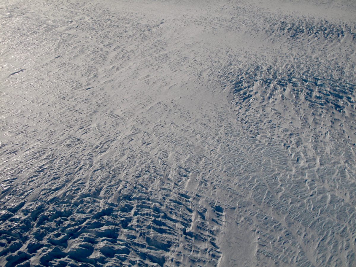
Crevasses affect ice flow, and thus sea-level rise, in multiple important ways. Crevasses provide entry points for water to reach the interior of a glacier or ice sheet, where it refreezes and warms the ice, reducing the viscosity of the glacier. Crevasses are the primary pathway for meltwater to reach the bed of a glacier or ice sheet, where it changes the hydrologic state and affects ice flow. Crevasses also structurally damage a glacier, reducing its bulk viscosity by accommodating deformation across crevasse planes. Finally, crevasses are the pre-existing fracture planes that allow calving of icebergs into the ocean. The magnitude of all of these effects on ice flow depend on the depth of crevasses, which is notoriously difficult to measure. To constrain the depths of thousands of crevasses across the Greenland and Antarctic Ice Sheets, we are applying remote sensing techniques to derive the surface width of crevasses, then applying a crevasse propagation model to convert those widths to likely depths. We anticipate depth accuracy of ~5-20%, with higher accuracy for deeper crevasses.
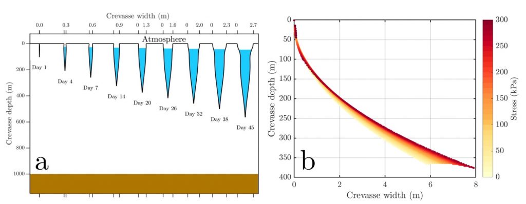
(b) Crevasse width (x) can be used to measure crevasse depth (y) if the stress state (colors) surrounding the crevasse is known. Here, we use remote sensing observations (ICESat-2, WorldView DEMs, and others) to measure crevasse width, and a crevasse propagation model (results shown here) to translate width to depth.
🧊
You can apply for a graduate research position at http://arts-sciences.buffalo.edu/geology/apply.html . UB Earth Sciences does NOT require the Graduate Record Examination (GRE) for admission to the graduate program.