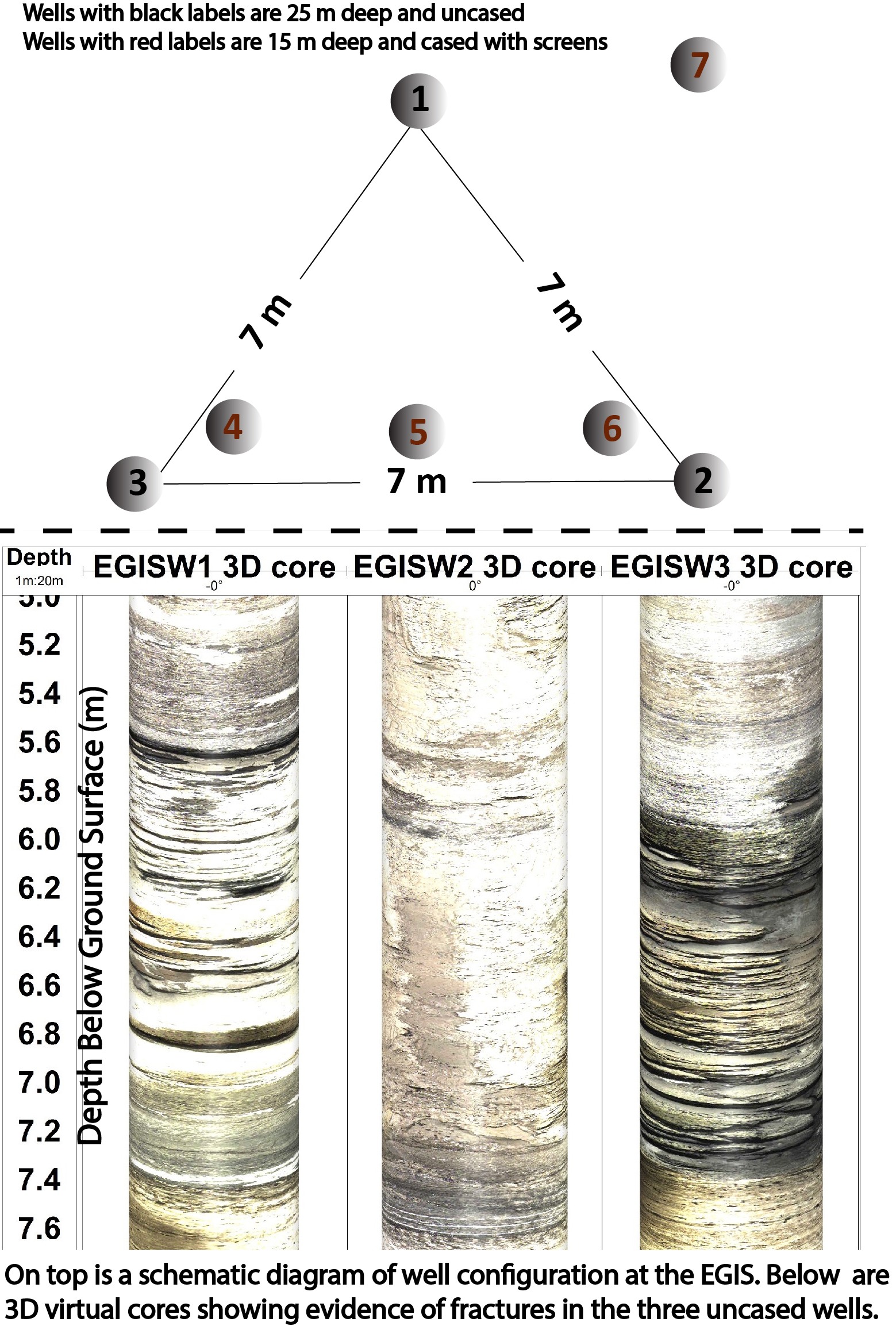
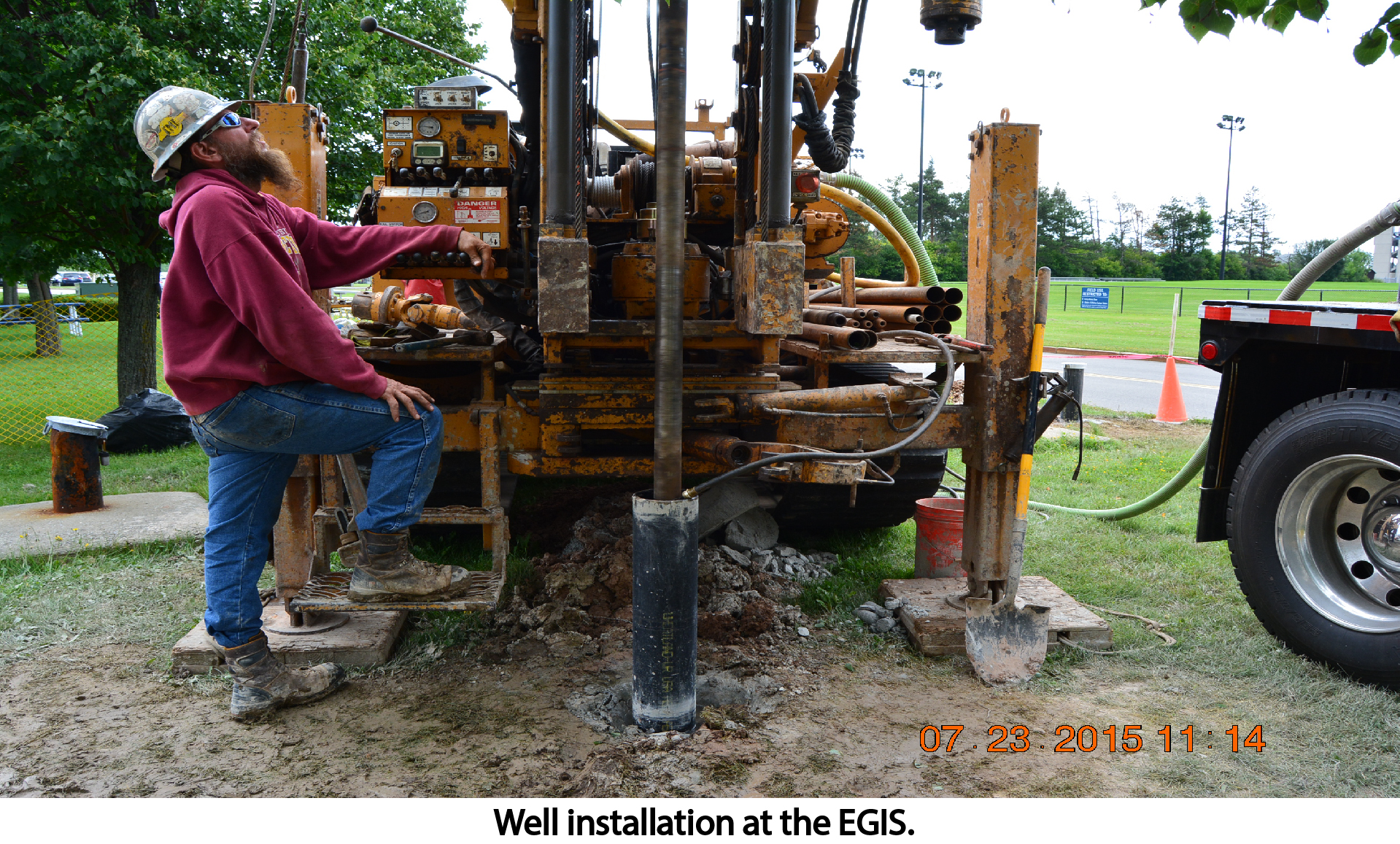
The Environmental Geophysics Imaging Site (EGIS) is an on-campus field-site where most of our field surveys and teaching labs are performed. There are seven installed wells comprising three 25 m and four 15 m deep wells.
Some Selected Surveys
The Environmental Geophysics Imaging Site (EGIS) is an on-campus field-site where most of our field surveys and teaching labs are performed. There are seven installed wells comprising three 25 m and four 15 m deep wells.
Some Selected Surveys